

Photo Log Map - Leave your photographing record on a map! app for iPhone and iPad
Developer: Canon Marketing Japan Inc.
First release : 16 Mar 2016
App size: 69.68 Mb
Product introduction
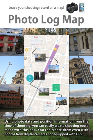
Photo Log Map is a logger app that makes it easy to create maps with shooting records that include photos.
It uses data from photos you shot, and the devices position information service, and makes it possible to easily create photo record maps.
Even with data from photos shot on digital cameras not equipped with GPS, by loading them onto the device, you can create a shooting record map linked to the log information.
* It may be difficult to acquire accurate position information from your devices position information service while moving at high speeds, or when there are barriers such as walls, a cars roof, tall buildings, or mountains.
Photo Log Map - Main Functions
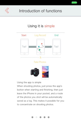
・Create log
- Record log information with the devices location information service while shooting.
- When shooting photos, just press the apps button when starting and finishing, then just leave the iPhone in your pocket, and a route of the photos you shot will be automatically saved as a log. This makes it possible for you to concentrate on shooting photos.
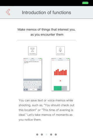
- During log recording, you can add text memos and voice memos at your current location.
・Create map
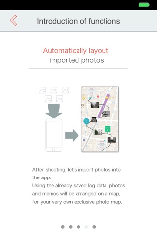
- You can create a shooting record map by selecting and loading photos shot while acquiring a log.
- Even with data from photos shot on digital cameras not equipped with GPS, by loading them onto the device, you can create a shooting record map linked to the log information.
- After shooting, lets import photos into the app.
Using the already saved log data, photos and memos will be arranged on a map, for your very own exclusive photo map.
- By tapping photos and memos on the map, you can confirm/modify their content.
- With the route display, you can display the route traveled on a map as a line.
・Sharing maps
- Maps you have created can be saved to the Camera Roll as image data with photos and text memos laid out automatically. In addition, they can also be attached to e-mail, or posted to Facebook and Twitter.
- With the export function, it is possible to export log data to create maps on other devices, or export GPX files for use with other apps. (Pay)
- You can add location information (latitude and longitude) to photos without Exif position information shot during log acquisition by Photo Log Map, and copy them to the Photo Log Map album folder.(Pay)
- You can print to Canon PRINT Inkjet/SELPHY compatible printers.Print size of A4 is recommended.
- You can print to AirPrint compatible printers.Print size of A4 is recommended.
Supported OS
iOS 8 and iOS 9
Supported devices
iPhone 5 / iPhone 5s / iPhone 5c / iPhone 6 / iPhone 6s / iPhone 6 Plus / iPhone 6s Plus
Notes:
・The loading image is only JPEG.
・Camera time settings and device time settings of when is deviated,
it will not be able to create a correctly shooting record map.Please use the combined set.
・Continued use of GPS running in the background, it may significantly drain the battery.
・It may be difficult to acquire accurate position information from your devices position information service while moving at high speeds, or when there are barriers such as walls, a cars roof, tall buildings, or mountains.